About Aviation Tools
AVIATION SOFTWARE TOOLS 1988
Colin Marshall, Ian Green Mathon Road, Malvern Worcestershire, WR14 4BU
I was given a copy of Pilots Companion ages ago to evaluate. It didn't come with a manual, I had no idea of what it did and so it has been dormant. Did anyone use it? Was it well marketed? I never heard of it again.
The company was based in Malvern but are no longer there. So here is your chance to trawl with me through the commands and get an understanding what this program did.
Pilots Companion
Download
This applications needs 32K of either EPROM or Flash space.
Introduction
Pilots Companion by Aviation Software Tools is written in BBC BASIC for the Cambridge Computer Z88 portable. It is a Flight Planner for Pilots.
It has several 'built-in' databases with Airfields, NDB, VOR. The user is invited to create, append,
The standard MENU and HELP facilities are not used in this application. The user will need to read this manual first to get a good overview of the product before use.
Pre-Flight Requirements
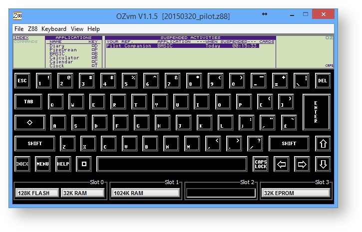
The requirements to run this program on the Z88 is at least 128K RAM in slot 1 and the Pilots Companion EPROM to be in slot 3. The EPROM must not be moved whilst using the program as the software checks that it is still there occasionally.
Pilots Companion requires a HARD RESET
Please BACKUP ALL YOUR DATA before using this program. It is designed to be used on its own.
Pilots Companion is started initially by giving the Z88 a Hard Reset, with the Pilots Companion's EPROM card in slot 3. The boot.cli file starts a chain of commands that sets :RAM.1 as the Default Device, fetches all the files from the
EPROM card and starts running the program. To leave the program press the key.
If Pilot Companion has already been used it will appear in the SUSPENDED ACTIVITIES area of the index from which it can be re-selected using the cursor bar.
When it is running, when in the INDEX it will be shown as a suspended activity with the file name used as YOUR REF. There can only be one Z88 Data Organiser application running.
Menu
Pressing the MENU key reveals 'no topics.' The Menus are in the main program itself.
Main Menu
To select a function on the menu, select the number that is required.
1 Current Plan
5 Repeat Current Plan
Check the route
Enter the current wind (no wind calculations as default)
Current route.
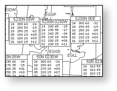
Look at the same route with wind calculations. 5230N 0230W @ 2000 ft. 200 15.
6 Print Current Plan
Sends this plan to the printer.
7 Save Current Plan
OX-WELLSB.SET and OX-WELLSB are generated.
8 Return Trip Plan
Select 1 Display Return Trip.
Check the route
Enter the current wind
Return route.
2 New Plan
Select 2.
Point of departure OXFORD is found. NORTHLEACH ROUNDABOUT is not.
USE DMS FORMAT
Latitude and Longitude can be given either as a decimal value or in Degree, Minutes and Second format.
Pilot Companion uses DMS. Using the wrong unit ensures errors.
Select 2.
Look up position (Lat & Long)
Look up the VRP
** BRIZE NORTON
0,51:50.250N,001:50.150W,0F,W,000 A40 NORTHLEACH ROUNDABOUT VRP
** BRIZE NORTON (ENR 2.1)
Enter Latitude and Longitude.
Select Y when the data is correct.
Look up position (Lat & Long)
EGBO:N/A:WOLVERHAMPTON:HALFPENNY GREEN:ENGLAND:52:31:03:N:02:15:35:U:0282
EGBP:N/A:KEMBLE:PAILTON:U.K.:51:40:05:N:02:03:25:U:0433
EGBS:N/A::SHOBDON:U.K.:00:00:00:U:00:00:00:U:0000
Enter another new way point for Kemble.
No more way points, press to continue,
To check headings, no wind data ia entered,
3 Old Plans
Load previously saved plans here.
4 Other Functions
Two more functions are selected here.
5 Airfield Data Bases
There are 6 choices
- ADD a NEW location.
- UPDATE an EXISTING location.
- Advanced user options, displays the next 3 options.
- SHOW a Data base ?
- APPEND to existing database ?
- CREATE a New Data Base ?
See Plan a Flight on how to use these functions.
6 Aircraft Functions
1 Check List
There are no check lists stored initially.
(1) Run a Checklist
Type the in file name (without the .CHK)
The first item to be checked is displayed.
Pressing the key displays the next item. This is repeated until the end of the list is reached. The program returns to the Main Menu.
(2) Create a New Checklist
Using PA28 as the Name of plane creates a file name of PA28.CHK
Type the first item that need to be checked, followed by the key.
Type the next item that need to be checked, followed by the key.
Pressing twice ends inputting the list and saves the file.
(3) Edit an existing Checklist
Type the in file name (without the .CHK)
The first item to be checked is displayed. Press
- (I) to insert
- (D) to delete
- (A) to accept
Pressing the key displays the next item. This is repeated until the end of the list is reached.
saves the updated data
leaves the data as it was before.
The program then returns to the Main Menu.
(4) To Exit
The program returns to the Main Menu.
2 Weight & Balance
Lets see what this does with some data
Here is a table for Normal Loading
| G-BPFH | Fuel - AVGAS (US Gallons) | Empty Weight (lbs) | Arm (ins) | Moment (wt |
|---|---|---|---|---|
| Aircraft basic empty weight | 1592 | 87.4 | 139,182 | |
| Oil Weight (lbs) | 0 | 0 | ||
| Fuel - AVGAS (US Gallons) | 40 | 240 | 95 | 22800 |
| Front Passengers (lbs) | 500 | 80.5 | 40250 | |
| Rear Passengers (lbs) | 200 | 118.1 | 23620 | |
| Front Baggage (lbs) | 70 | |||
| Rear Baggage (lbs) | 142.8 | |||
| RAMP WEIGHT AND MOMENT | ||||
| Fuel allowance for engine start, taxi, and run-up | -8.0 | 95.0 | -0.76 | |
| TAKEOFF WEIGHT AND MOMENT (max 2550 lbs) | 2524.34 | 90.00615 | 227.206128 | |
| Min CG | 88.1664 | |||
| Max CG | 93 | |||
| RESULTS | Normal category | |||
Enter data
The data from the table above is entered.
- Empty Weight (lbs)
- Datum (in)
- Oil Weight (lbs)
- Datum (in)
- Fuel - AVGAS (US Gallons)
- Datum (in)
- Front Passengers (lbs)
- Datum (in)
- Rear Passengers (lbs)
- Datum (in)
- Front Baggage (lbs)
- Datum (in)
- Rear Baggage (lbs)
- Datum (in)
Result
The following result from Pilot Companion was obtained. It is within the calculations obtained from the table.
Press <ENTER> to continue
The program returns to the Main Menu.
3 Density Altitude
Enter some valid entries
Calculate Density Altitude
Calculate True Airspeed
4 Descent Rate
Give Distance to Run 1
Give Rate of Descent 2
Quit 3
The program returns to the Main Menu.
Files & Databases
| EPROM | RAM | Function |
|---|---|---|
| /boot.cli | boot.cli | Change default RAM to :RAM.1 |
| /EPROMLOAD | EPROMLOAD | Program to fetch all files from EPROM to RAM |
| /settings.dbf | settings.dbf | |
| /data.dbf | data.dbf | Airfields Database |
| /way.dbf | way.dbf |
|
| /UPD.DBF | UPD.DBF | |
| /vor.dbf | vor.dbf | VOR Database |
| /pos.cli | pos.cli | #-P |
| /pon.cli | pon.cli | #+P |
| /ndb.dbf | ndb.dbf | NDB Database |
| /eram | eram | Select :RAM.- erase files |
| /way2 | way2 | BBC BASIC Program |
To get some idea of what data is there, here is a Pipedream view of the data.
rev and temp are used for the current plan.
data Airfields DBase | vor | ndb | upd | way | way2 |
|---|---|---|---|---|---|
data.dbf(c) 1988ast | vor.dbf(c)1988ast | ndb.dbf (c)1988 | upd.dbf | WAY | BBC BASIC |
ABERDEEN | ADN | AQ | RTY | NEARAB | |
571215N | 571838N | 570818N | 572359N | 572359N | |
021155W | 021556W | 022411W | 020717W | 020717W | |
EGPD | VOR 114.3 | NDB 336.0 | Q | Q | |
ALDERNEY | BKY | ADN | |||
494225N | 515944N | 571608N | |||
021248W | 000359E | 021453W | |||
EGJA | VOR 116.25 | NDB 377.0 | |||
ANDREWSFIELD | BEL | AP | |||
515340N | 543940N | 520659N | |||
002705E | 061344W | 043334W | |||
EGSL | VOR 117.2 | NDB 370.5 | |||
Plan a Flight
Let's go to AV8 restaurant at Kemble via Northleach Roundabout for lunch from Oxford.
Select
Select 4 Other Functions
Select 5 Airfield Data Bases
Select 1 ADD a NEW location or
Select 2 UPDATE an EXISTING location
gives the following menu:-
Select 3 Advanced user options
4 SHOW a Data base ?
6 CREATE a New Data Base ?
Add a Record, or new entry.
NORTHLEACH ROUNDABOUT
Select 2.
Point of departure OXFORD is found. NORTHLEACH ROUNDABOUT is not.
USE DMS FORMAT
Latitude and Longitude can be given either as a decimal value or in Degree, Minutes and Second format.
Pilot Companion uses DMS. Using the wrong unit ensures errors.
Select 2.
Look up position (Lat & Long)
Look up the VRP
** BRIZE NORTON
0,51:50.250N,001:50.150W,0F,W,000 A40 NORTHLEACH ROUNDABOUT VRP
** BRIZE NORTON (ENR 2.1)
Enter Latitude and Longitude.
Select Y when the data is correct.
Look up position (Lat & Long)
EGBO:N/A:WOLVERHAMPTON:HALFPENNY GREEN:ENGLAND:52:31:03:N:02:15:35:U:0282
EGBP:N/A:KEMBLE:PAILTON:U.K.:51:40:05:N:02:03:25:U:0433
EGBS:N/A::SHOBDON:U.K.:00:00:00:U:00:00:00:U:0000
Enter another new way point for Kemble.
No more way points, press to continue,
To check headings, no wind data ia entered,


